During these surveys, we will be collecting important information about the area’s geology; mineralogy; groundwater depth and salinity, and ambient temperature.
Thermal data along the cable route, especially at landfall, is also required to understand the maximum power transmission capacity of our export cable. We collect this data by measuring the temperature and conductivity of rocks, soil, and underground layers to understand heat flow. This will inform the size of our windfarms and the amount of wind power they can feed into the grid.
What we’re doing
Weather and ground conditions permitting, we will work Monday to Sunday from Wednesday 2 July until mid-September 2025. Work will take place in daylight hours, notionally between 7:00 am and 6:00 pm.
Work will consist of:
- acoustic surveys (using sound waves) to explore and map the underground and help select borehole locations behind the dunes,
- assessing the thermal properties of the soil and measuring how hard it is underground by pushing a small probe into the soil or rock, and
- borehole drilling and sampling to determine additional subsurface conditions and compositions.
Surveys will be carried out exclusively on public land and will involve a combination of vehicle-based and manual labour.
What to expect
We have been working closely with Wellington Shire Council, Gunaikurnai Land and Waters Aboriginal Corporation, VicGrid, Parks Victoria and DEECA to plan for these works. We’ll make every effort to minimise how our work impacts you, however you may notice:
- vehicles and survey personnel in the area,
- temporary increases in noise and vibration from survey activities and vehicle movements,
- a small observation borehole which will monitor groundwater levels for one year,
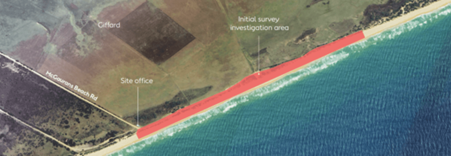
- a temporary site office established at the end of McGauran’s Beach Road.
Where required to safely complete this work, temporary fencing will be erected around our worksites. Public access to the beach and McGaurans Beach Road will be maintained at all times.
We’ll leave the beach how we found it and return any affected areas as close as possible to their original condition. We will complete this work in stages and reinstate areas as we go to minimise our footprint.
If you have any questions about the survey program you can email us at infoaustralia@orsted.com.