Marine environmental studies

Gippsland offshore wind farms

Understanding the marine environment

While offshore wind farms provide significant environmental benefits by producing clean energy, we must ensure that we understand and minimise impacts to the marine and wider environment.
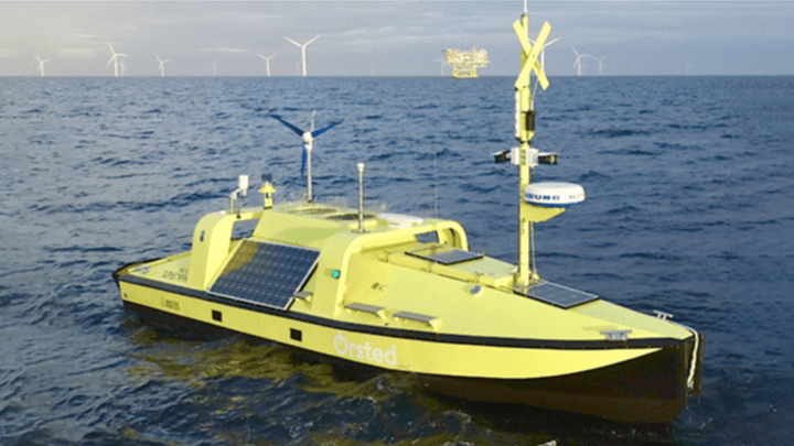
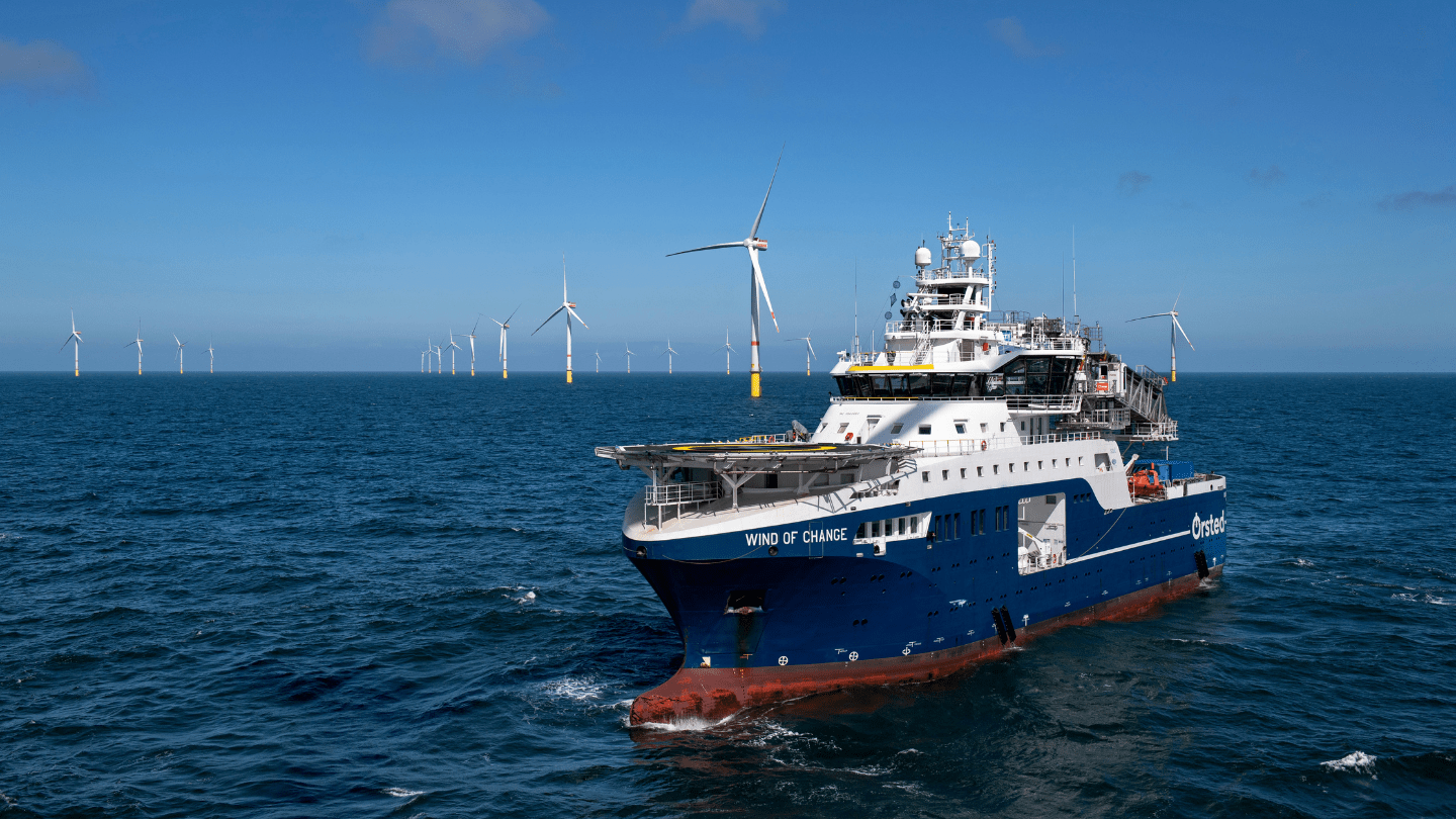
As the largest operator of offshore wind turbines in the world, Ørsted uses its experience to map and measure the marine environment well before its projects are built. This allows us to plan our projects so they reduce marine impacts throughout construction and operations.

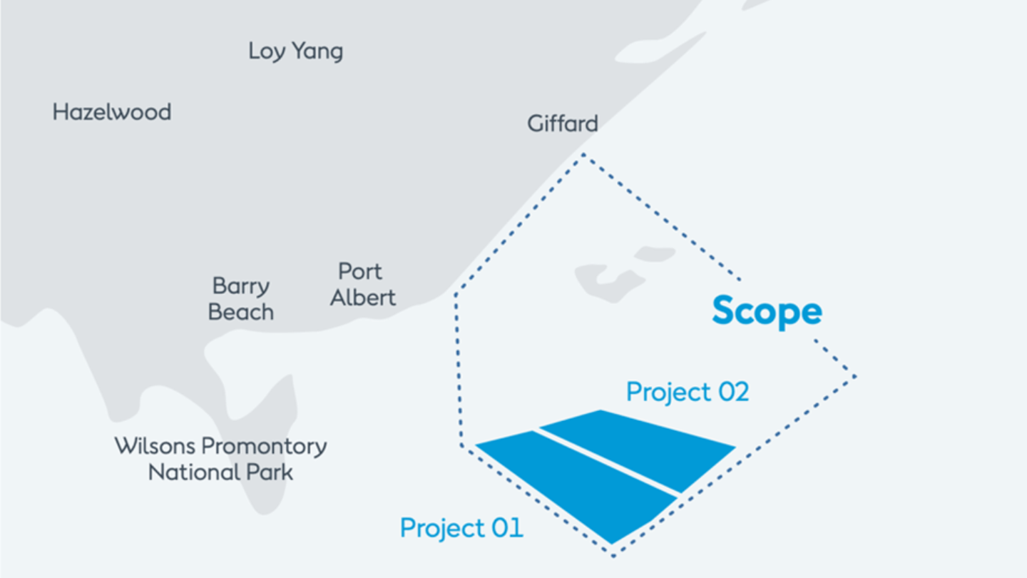
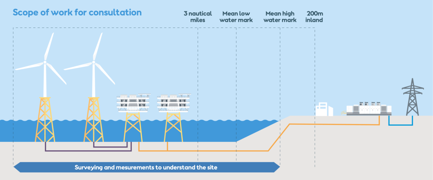
Marine environmental baseline surveys are helping us understand all aspects of the unique Bass Strait marine environment and will shape our eventual project design.

  
Several different survey studies will be conducted to help us better understand the site
where our offshore wind projects
are proposed. Studies will
also look at a potential ‘corridor’ that could host an underground cable for exporting power
from the wind farm to shore.

Early feasibility studies

Ørsted’s Gippsland offshore wind projects are currently in the feasibility phase. In May 2024, the Australian Government granted Ørsted feasibility licences under the OEI Act, which allow us to seek consent to conduct surveys and measurements of the seabed,
up to a period of seven years. This comprehensive work is now underway and will
continue for up to seven years.

No wind farm infrastructure can be built until these studies are complete and development plans are assessed and approved.

What we will be doing

Marine and avian observation
Environmental surveys will collect important baseline data through different seasons. Community input will also help shape these studies, by spotlighting local environmental values locals care deeply about.

This includes targeted surveys of species like whales, dolphins, seabirds and shorebirds, using local natural science professionals on boats, planes and acoustic techniques. Marine ecology surveys undertaken via approaches such as sampling and remote underwater video studies will also help our understanding about the ecological environment and benthic habitats, etc.
Wind, weather and ocean conditions (Floating LiDAR)
A sophisticated system measuring wind and metocean (physical weather and ocean) conditions at the project site. Data captured is integral to mapping wind speeds and local oceanographic conditions and will allow us to optimise the eventual operation of the wind farms.
Seabed and subsurface mapping (Geophysical testing)
Non-invasive scanning of the seafloor using echo sounding and sonar to better understand the seabed’s features, avoid submerged shipwrecks or other hazards, and plan for the safe placement of wind turbine footings and other infrastructure.
Soil strength / property measurement (Geotechnical sampling)
Understanding the composition of the subsea floor is important as it helps us choose locations that will provide a strong foundation to build our wind turbines on. These studies use a small test module attached to a vessel to conduct penetration tests. Sediment samples will also be taken from the seabed using grab samplers. Test locations are pre-screened to avoid existing infrastructure like cables and require only a small window of time (usually 4 hours) to complete.

Undertaking metocean surveys

Ørsted will complete its metocean surveys using latest state-of-the-art technology developed in-house – an Uncrewed Surface Vessel (USV). USV’s are small (approximately 10 metre long) vessels designed for long-endurance surveys at sea. The USV was developed with safety at its core as it enables remote operations of the vehicle. An escort vehicle is used when the USV is in transit to avoid interference with other marine vessels, and will convert into buoy mode once at site as it anchors to the seabed.

Reach out to us

If you have any questions about our proposed project or would like more information,
feel free to reach out to us.